
San Mateo Street Directory Walkthrough
A San Mateo street directory workflow moves from a fixed place through several records. Start with the full address. ACRE Property Maps supplies an APN and recorded-map links; county GIS displays parcels and layers; City CSS searches permits, plans, inspections, code cases, and business licenses by address or shape. The Recorder is name-based, voter tools are limited, and historical criss-cross directories reverse a number into a printed name clue.
Write down the exact value returned at each step, including spelling, date, status, APN, and document number. A partial match needs another source.
- Address to APN. Enter the address in ACRE Property Maps. Preserve the nine-digit APN form, such as 0XX-XXX-XX0, beside the situs.
- APN to GIS. Click the parcel in county or city maps and note Map Tips, nearby parcels, districts, hazards, and neighborhood layers.
- GIS to permits. Search CSS by address, APN, permit number, or date. Point, Line, Polygon, and Circle shapes can collect a street segment.
- Permit to deed index. Use a party clue in the ACRE Grantor-Grantee Index. It is name-based and image-free online.
- Qualified voter check. My Election Info is personal. A voter-file request needs an approved purpose and identifiers.
- Address to history. Check the 1976-1995 criss-cross run, 1907-forward directories, newspapers, and Sanborn maps.
- Verify the role. Keep deed parties, permit contacts, voters, subscribers, and household clues separate.
The chain is designed for address research. When the question shifts from a whole street to one person, the San Mateo resident lookup workflow supplies the identity checks; older volumes are treated as collections on the historical directory page.
San Mateo Property Map Search
ACRE’s Property Maps workflow is the first address key. HOME accepts Find parcels by ADDRESS or APN. PROPERTY MAPS adds assessor book and page, Parcel Map, and Subdivision Map volume and page searches. Results link to recorded maps, with free PDF downloads; official copies can follow a separate counter route.
No public online owner-name search is documented. Start with the parcel, not an assumed person. A mailing address belongs to an assessment or tax record and can differ from the physical situs.
The ACRE Assessor Maps instructions show the address, APN, and recorded-map search paths.
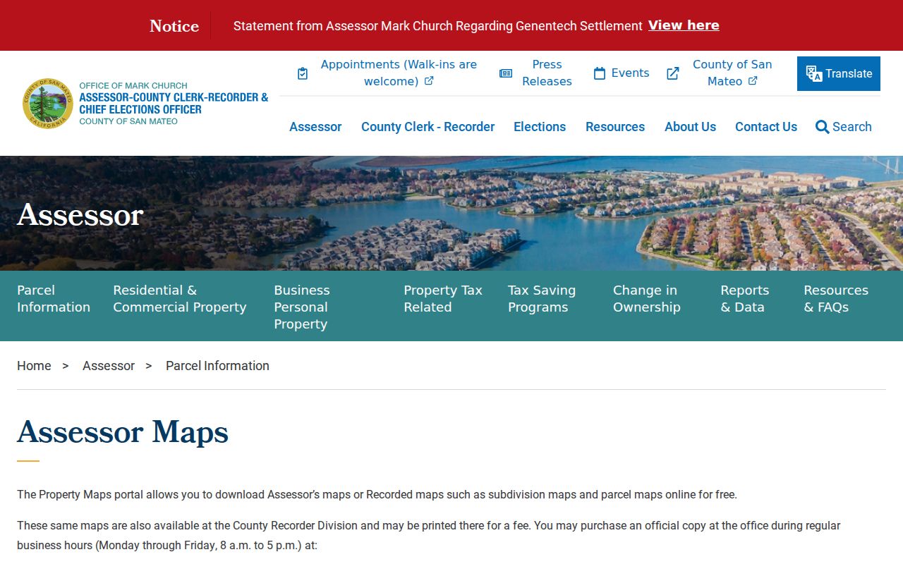
The workflow gives a street directory search a parcel key before names and dates enter the chain.
| Search field | Type | Required path | San Mateo format or note |
|---|---|---|---|
| Address | Text | One search key | Find parcels by ADDRESS |
| APN | Text | One search key | Planning GIS shows a form such as 0XX-XXX-XX0 |
| Book and page | Paired text or select | One map mode | Assessor-map search |
| Map family | Choice | One map mode | Parcel Maps, PM, or Subdivision Maps, RSM |
| Volume and page | Paired controls | One map mode | Recorded-map retrieval, then Next |
| Search or Next | Button | Yes | Runs the selected mode |
San Mateo GIS Street Geography
County Planning GIS adds a visual street layer. Remove dashes and spaces from the APN, choose Find parcels by APN, click Search, then open the highlighted parcel. Map Tips reads active layers. Groups include land use, zoning, districts, flood, fire, airport hazard, scenic corridors, agriculture, and coastal constraints.
For an incorporated San Mateo address, city applications are better for city zoning, associations, historic resources, flood information, and civic geography. The city cautions that web maps do not guarantee boundary or service accuracy. Retain the source name with the parcel note.
The San Mateo Maps and GIS page provides the city map entry points.
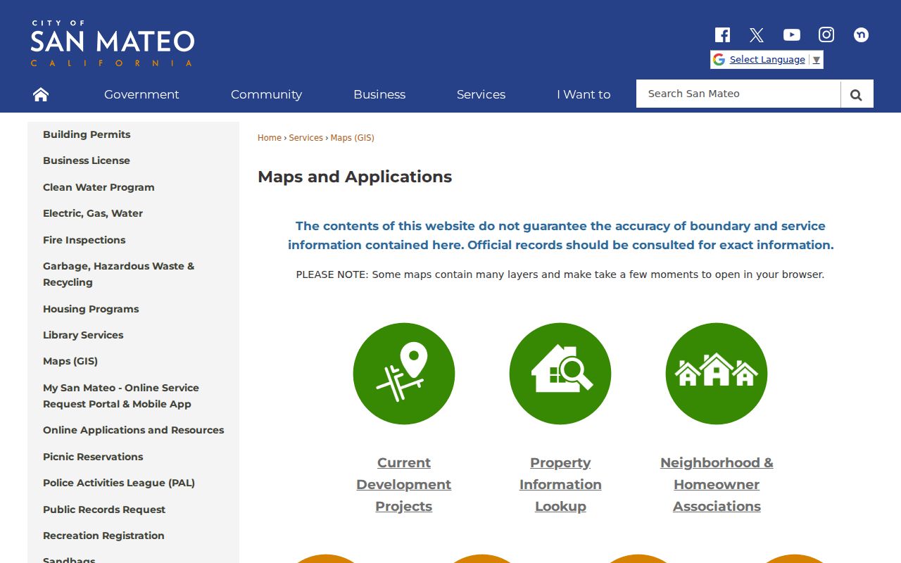
City layers distinguish a neighborhood or planning boundary from a parcel line. They do not list everyone along the street.
The San Mateo County parcel viewer supplies the county-side map context for adjacent parcels and active layers.

The county viewer is free informational access after its disclaimer. Use its parcel key with city layers when a street crosses a jurisdiction or postal boundary.
San Mateo city, San Mateo County, and USPS “San Mateo” can describe different boundaries. State whether an address is inside the city, merely in the county, or using a postal label, especially near Hillsborough, Belmont, Foster City, and unincorporated edges.
San Mateo Permit Search Fields
City CSS is the address-keyed public search for permits, plans, inspections, code cases, and business licenses. No account is needed to search. The live Customer Self-Service search and the CSS User Guide describe the route. Its Esri map accepts a full or partial address, and Draw to apply or Draw to search accepts a Point, Line, Polygon, or Circle. A line can collect addresses touching a block.
Results can show an address or APN, project details, inspections, contacts, and case history. A finaled permit can date an addition or demolition; a code case can show an observed condition and status. Neither proves ownership or occupancy. Logged-in and logged-out filters differ, and export behavior was not documented.
The City permits and business-license page is the official entry point for the CSS search.
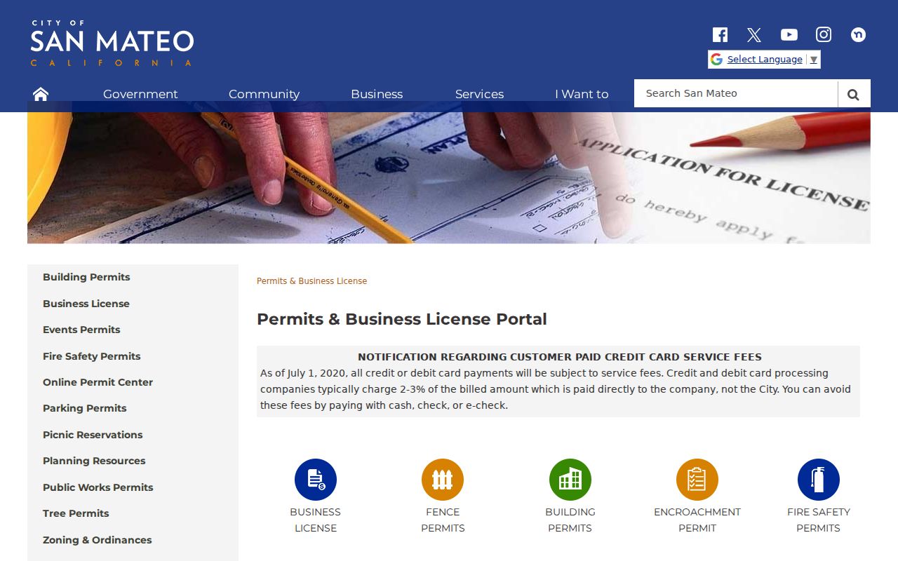
Permits add project evidence to a street directory trail, not a list of people at an address.
| CSS control | Type | Required | Options or notes |
|---|---|---|---|
| Search category | Dropdown | Yes | Permit, Plans, Inspections, Code Cases, Business Licenses |
| Address | Text or autocomplete | No | Whole or partial address |
| Date range | Date pair | No | Narrow created or issued records |
| Permit number | Text | No | Last six digits accepted for a number such as BD-2019-123456 |
| Parcel number | Text | No | APN |
| Interactive map | Spatial control | No | Address search or Point, Line, Polygon, Circle |
| Search | Button | Yes | Executes the query |
Street Records Across San Mateo
The San Mateo street directory chain works because each record set contributes a different address clue. Property Maps supplies parcel links, GIS supplies adjacency, CSS supplies project history, the Recorder supplies indexed parties, Elections supplies a limited status route, and criss-cross volumes supply historical address-to-name clues. None is a complete street list.
| Address-keyed record | Keeper | What it shows | Access |
|---|---|---|---|
| Property Maps and parcel records | ACRE Assessor | APN, situs, maps, parcel links | Address or APN; owner-name access not documented |
| County and city GIS | Planning, TSD, and City GIS | Parcel shapes, districts, hazards, neighborhood layers | Free informational viewers |
| Permits and code cases | City Community Development | Work, contacts, inspections, status, project chronology | CSS public search; no account for search |
| Deeds, liens, and releases | ACRE Recorder | Grantor, grantee, document type, date, number | Free index; copy order or public terminal for images |
| Voter information | San Mateo County Elections | Personal status or qualifying file fields | Authenticated or approved-purpose access |
| Criss-cross and city directories | Library and institutional collections | Published occupants, subscribers, names, and addresses | Reference, microfilm, or collection access |
The APN can link maps, permits, and a deed description, but a street name does not make one population. Record the date, source role, and current or historical status. This prevents a permit contact or indexed grantee from being mistaken for every person at a parcel.
San Mateo Deed Chain by Address
A deed chain begins with the current parcel, not a guess about a former resident. Capture the APN, situs, and legal description. Search the current grantee in the ACRE index, order the acquisition deed, and transcribe seller, date, number, vesting, and description. Search the seller as an earlier grantee. Trust deeds, releases, liens, quitclaims, probate decrees, and interspousal deeds can complicate the sequence.
Keep the legal description constant. An address can change, be renumbered, or serve more than one unit. If the web result lacks an image, use the public terminal or copy order at ACRE.
A seller’s later address is only a clue. It may be a mailing, business, trust, or other parcel address.
San Mateo Recorder Index Limits
The Recorder’s Grantor-Grantee Index searches the names supplied by an instrument. Documented fields include grantor or grantee, recording date or range, document type, document number, and Search. The full live type list was not exposed, so use the choices shown at search time.
ACRE excludes images from the web index for privacy reasons. The ordered image holds legal description, signatures, notary acknowledgment, return address, and operative clauses. The online cutoff is not published, so older street work should include a counter or public-terminal question about books and microfilm.
Party roles matter. A trust, lender, lien claimant, court, or attorney may appear beside a parcel without being a household clue. If the street directory goal is a title history, follow the deed. If it is a one-person identity question, use at least two stable facts and a separate custodian.
San Mateo Criss-Cross Directories
Criss-cross directories reverse the usual name-first order. The Library of Congress identifies a San Mateo County run from 1976-1995. A volume can list a street, number, and subscriber or occupant clue, bridging modern parcels and older alphabetic city directories.
Read the volume’s instructions and abbreviation key. Publication lag, unlisted numbers, spelling variants, vacant parcels, and omissions can create a false break. Transcribe the address and name, then compare another edition. An entry proves a published association for that edition, not presence every month or everyone in a home.
The Library of Congress criss-cross inventory confirms the San Mateo County address-directory run. For the full historical shelf, use the San Mateo city-directory collections rather than repeating the modern parcel workflow.
San Mateo Sanborn Address Clues
Sanborn fire-insurance maps add place context before ZIP and parcel systems. The Library of Congress has a July 1897 San Mateo edition with six sheets; the Main Library holds 1920s-1930s sheets. They show footprints, materials, uses, street names, numbers, and change, but identify structures rather than residents.
Compare a footprint and number with a 1907-forward directory, deed description, and permit. A number change can explain a failed historical search. No verified San Mateo renumbering schedule was found, so document a change from a map, directory, ordinance, or deed.
The 1897 San Mateo Sanborn map record is a useful historical address clue when a modern parcel needs a structure date.
San Mateo Voter Street Limits
My Election Info is a personal lookup for registration, representatives, and vote-by-mail tracking. Fields use first name, last name, date of birth, and an identity field such as a California ID or last four SSN digits when requested. These authenticate the voter; they are not a public street key.
California voter-file release is limited by Elections Code sections 2188 and 2194 and related regulations. Qualifying purposes include election, scholarly, journalistic, political, or governmental work. A limited request needs full name, date of birth, county, and residence address, plus fees and certification. “Inactive” does not prove a person left an address.
Safe at Home participants and other confidential voters are withheld or specially controlled. A street directory should describe that boundary plainly instead of implying that a voter roll supplies a neighborhood list.
San Mateo Parcel Definitions
Four terms keep an address search precise. They describe record structure, not a promise that a name appears.
- Parcel
- A mapped unit of land associated with an APN and a recorded map relationship.
- Situs address
- The physical location of the property. It differs from the mailing address used for tax or assessment correspondence.
- Plat
- A recorded map describing lots, blocks, streets, or subdivision geometry, including Parcel Maps and Subdivision Maps.
- Criss-cross directory
- An address directory arranged by street and number, often showing a listed occupant or telephone subscriber for a particular publication period.
Keep the legal description with the APN when an old street number changes.
San Mateo Street Privacy Limits
A street directory cannot show every person connected with a home. Deeds identify recorded parties. Assessor materials tie records to parcels. Permits show project contacts and inspections. Utilities generally protect customer accounts. DMV address data is restricted by the federal Driver’s Privacy Protection Act. Household members who are not in a public record remain outside the address chain, and protected participants can be withheld from public systems.
Lawful use. San Mateo street and address records are suitable for personal, lawful research, family history, civic review, and property curiosity. Using a name or address to stalk, harass, threaten, impersonate, or harm anyone is prohibited and can carry legal consequences.
Use official sources for the narrow question they answer, retain the date and record identifier, and stop when the custodian applies a privacy, sealing, confidentiality, or purpose restriction. A gap in the street directory is often a boundary of the record system, not evidence that a person or event did not exist.